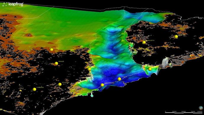
3D mapping of NSW
Example of depth of cover
The 3D geoscience project generates 3D models representing the lithology and structures of basin and orogenic provinces at scales ranging from statewide to local. The models have applications for land-use management, mineral and energy resource exploration, scientific research, water resource management, civil engineering and waste management. The 3D models add significant value to existing and future geoscientific datasets and inform decision making in government and industry.
- The statewide modelling program is developing a series of interlocking province-scale models. Models at this scale will incorporate digital terrain, basin and basement interfaces, major tectonic subdivisions, crustal-scale structures, major stratigraphic horizons and geological period boundaries.
- Basin-wide integrated 3D models include all the major stratigraphic units and structures such as faults and folds. These projects collate, audit and refine 3D data from previous studies and reports to generate new 3D surfaces for the whole of the basin.
Base data for 3D modelling includes seamless geological maps, seismic sections, drillholes (petroleum, minerals, coal and water bores) structural measurements and geophysical images. Along with the 3D model products, the data integration highlights gaps in data and geological understanding that will focus future work. The models are dynamic and are updated as new data is collected.
3D Models currently available: