Forbes-Dubbo
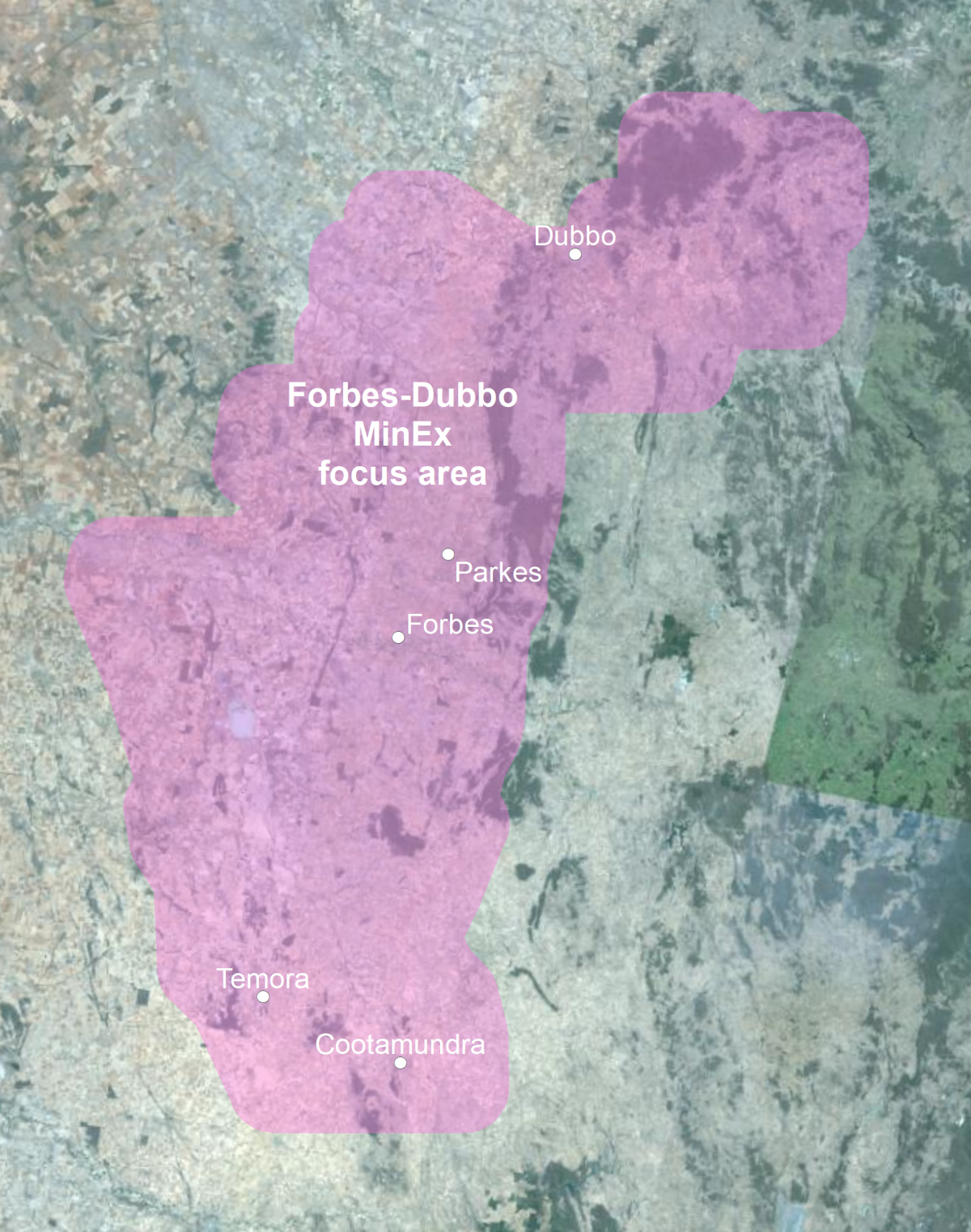
MinEx Cooperative Research Centre (MinEx CRC) activities will be undertaken over the Macquarie Arc, in the greater Forbes to Dubbo region by the Department of Primary Industries and Regional Development’s Geological Survey (GSNSW) (Figure 1).
Location map of the Forbes-Dubbo MinEx focus area
Figure 1: Location map of Forbes-Dubbo MinEx focus area
Current activities
Geological mapping and sampling
Rock samples will be collected from outcrops and existing drillhole material during ongoing field mapping and core library visits. Samples will be analysed for geochemistry, mineralogy and age dating. View more information and a video explaining geological mapping here.
The data acquired will be analysed and synthesised and gradually made available through MinView. Results will also be incorporated into the NSW Seamless Geology Geodatabase, which is available on MinView.
Completed activities
Two audit and gaps studies of the area are available on DIGS (Forbes region GS2019/1238 and Dubbo region GS2020/0185). Ongoing geological mapping and sampling will address recommendations in these reports.
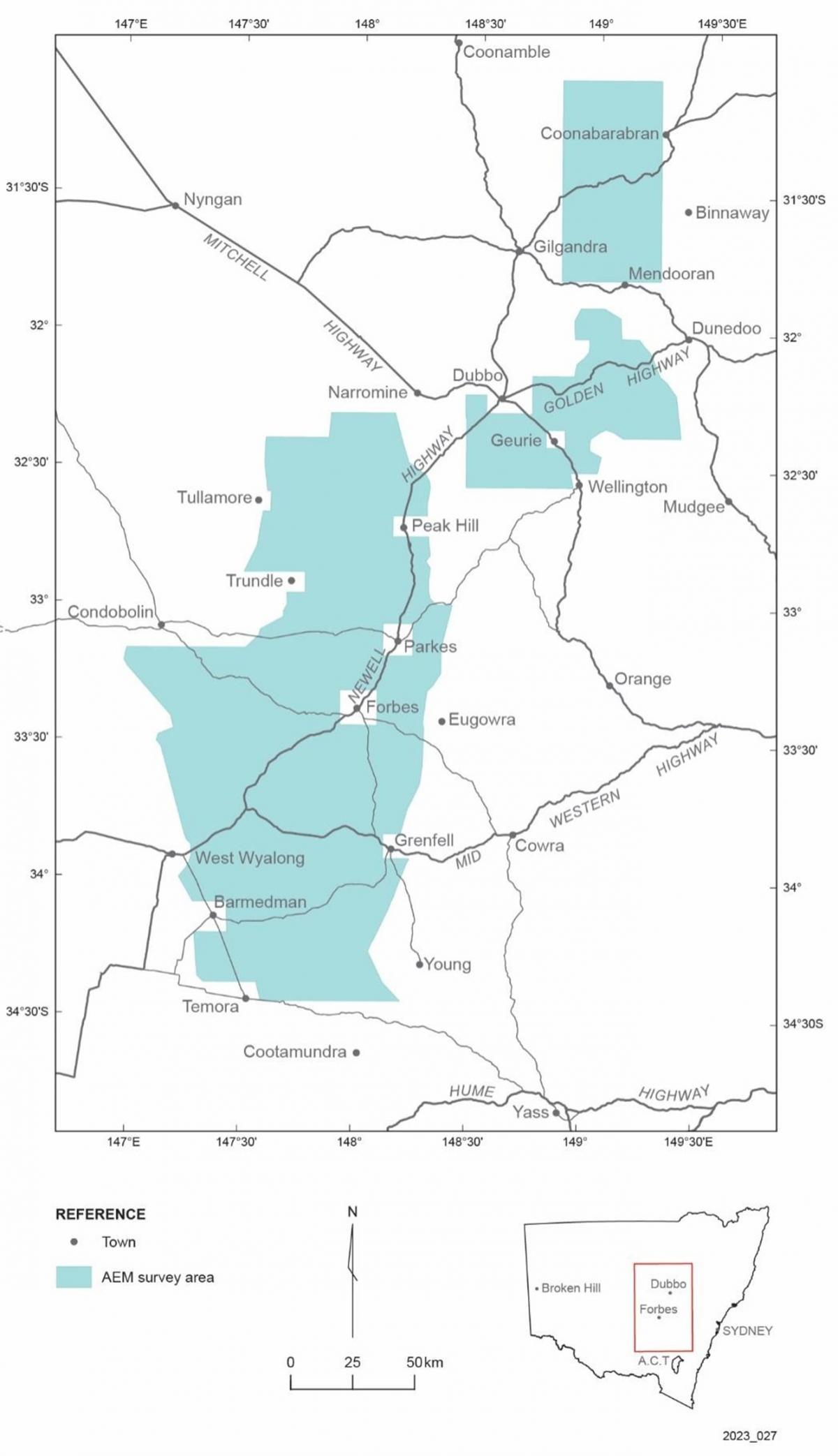
Forbes–Dubbo Airborne Electromagnetic (AEM) Survey
In May to June 2023, GSNSW and Geoscience Australia carried out an airborne electromagnetic (AEM) survey to measure the natural electrical properties of rocks and soil up to 400 m deep in the greater Forbes to Dubbo region. These properties vary depending on the type of rocks and soil, and the water content and salinity. The data collected will help to improve our knowledge of the geology and groundwater resources of the area. It will be used to make informed decisions by mineral explorers, the government, and farmers.
This survey was undertaken to support three projects, MinEx CRC, the Drought-Proofing Project and the Critical Minerals and High-tech Metals Strategy. The Drought-Proofing Project involves searching western NSW for rocks with the potential to host deep groundwater or store groundwater in times of surplus. Data collected from the AEM survey can be used to help identify areas with potential deep groundwater and those that could store groundwater.
The MinEx CRC project has groundwater synergies with the other project and will focus on minerals and geology, to help NSW discover critical minerals needed for a cleaner, greener NSW.
Critical Minerals and High-Tech Metals Strategy outlines the NSW Government’s vision to build on our existing potential and position NSW as a major global supplier and processor of critical minerals and high-tech metals well into the future. Rocks in the greater Forbes–Dubbo region host critical and high-tech metals, so the AEM data acquired will help the government assess potential resources.
A specialist and experienced contractor undertook the survey. A helicopter flew at a height of 70 m, with a sensor suspended 35 m below it. The lines were typically about 60 km long and up to 2.5 km apart.
When NSW National Parks and Wildlife Service requested assistance from GSNSW to find groundwater in the Warrumbungle National Park, the survey was extended to cover the Coonabarabran region, where lines were spaced up to 7.5 km apart, or closer over the national park.
The data will be made publicly available after it is processed. To receive it please email geophysics.products@regional.nsw.gov.au.
A comprehensive community engagement plan was actioned to inform the community and stakeholders about the survey. A slideshow about the survey can be viewed here (PDF, 3.43 MB).
Figure 2: Survey area
The Forbes-Dubbo AEM survey area and extension (Download zipped shapefile).
Hydrogeochemistry
A 60-sample hydrogeochemistry (water sampling) survey was completed between July and October 2020 as part of an initial study of groundwater chemistry in the Forbes region (see figure below). Each sample was analysed for a range of elements as well as parameters such as salinity and pH. As part of the survey, an additional 13 samples were collected for radiocarbon dating to provide insight into the residence times of groundwaters in the region. The analytical results were forwarded to landholders in July 2021 and are available on MinView. To download the data, click Tools > Data download > Hydrogeochemistry.
The results of this survey were synthesised in an interpretive report (by CSIRO and Geological Survey of NSW researchers) available here.
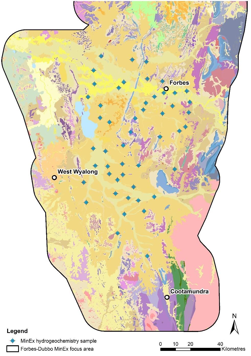
Figure 3: Map showing the Forbes MinEx CRC hydrogeochemistry sample locations overlain onto the surface geology layer of the NSW Seamless Geology dataset.
Whole rock geochemistry
Ten new whole rock geochemical analyses have been obtained across several igneous units in the Forbes region through a combination of outcrop and drillcore sampling. A comprehensive suite of elements as well as bulk-density was determined for each sample, which cover a range of basic through to silicic rock types. The units sampled include the Currumburrama, Parkes and Carawandool volcanics, and the Bundaburrah Granodiorite. The analytical results are now available for download on MinView, as part of GSNSWs whole rock geochemistry dataset. To download the data, click Tools > Data download > All whole rock geochemistry. Within this dataset the new analyses within the Forbes focus area are found by searching the dataset using the sample number project identifier ‘MXFO’.