Cobar
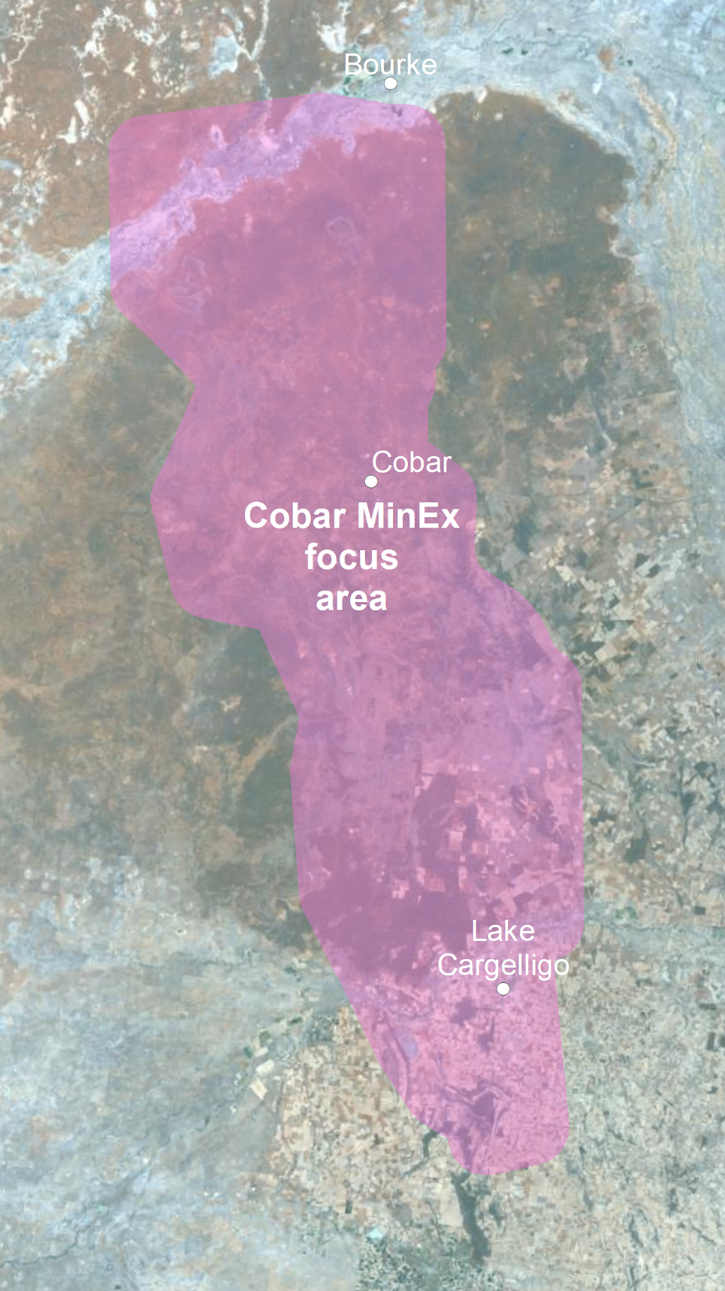
MinEx Cooperative Research Centre (MinEx CRC) activities are being conducted across the greater Cobar region by Department of Regional NSW's Geological Survey (GSNSW) (see map below).
Figure 1: Location map of the Cobar MinEx focus area.
Current activities
Geological mapping and sampling
Geological mapping and sampling of rock outcrops in the Cobar area has been ongoing since 2020. The data acquired is being analysed and synthesised and will become gradually available through the NSW Seamless Geology dataset (also available on MinView).
See the section below - Other publications and presentations for links to published reports.
Geological mapping and sampling of rock outcrops and existing drill core continues in the Cobar region in 2023.
Community information sessions
GSNSW has prepared an online information session about the Cobar AMR survey. A recording of the webinar is available here:
Cobar MinEx CRC airborne magnetic and radiometric (AMR) survey from DPIE Training & Education on Vimeo.
You can also find out more about the AMR survey process here.
Completed activities
Cobar - Yathong seismic survey
A seismic survey was undertaken to better image major faults in the Cobar area and the geometry of the Cobar Basin. This type of ground-based geophysical survey is low impact. Seismic surveys help to build an image of the geology under the ground. Vehicles move along a route and generate energy vibrations that penetrate the ground and bounce off buried rocks. The reflected energy is recorded by a series of sensors.
Following roads, fire trails and existing farm tracks, no clearing of vegetation or soil was necessary for the survey. Disturbance to traffic, residents, livestock and wildlife was minimal. Two trucks transferred sound energy to the ground and were supported by vehicles for equipment, communication and personnel. When the survey was complete, all equipment was removed from the site.
Map showing completed seismic lines
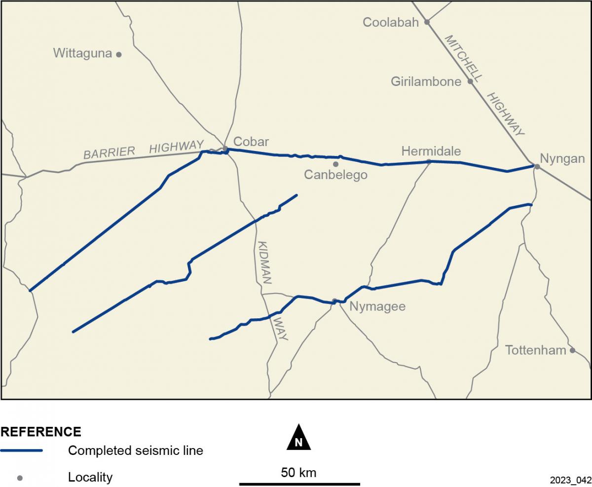
Three lines were surveyed. Two cross the northern part of the Yathong–Ivanhoe Trough, which will help map deep groundwater resources . Continuing eastward, the lines cross the Cobar Basin and finish near Nyngan. Data over this area will be used to better understand the rocks underground and mineral systems in the region. The survey started in April and finished in June 2023.
The data will be processed then released late in 2023. If you would like a copy of the data please email minex.crc@regional.nsw.gov.au
Hydrogeochemistry
Water sampling was conducted in May to September 2019 across the greater Cobar region. 86 samples were collected from existing waterbores then analysed for a range of elements and parameters such as salinity and pH. The age of some of the water samples was determined. Results were forwarded to landholders in May 2020 and are available on MinView. To download the data, click Tools > Data download > Hydrogeochemistry.
An accompanying interpretive report (by CSIRO and Geological Survey of NSW researchers) was released in March 2021.
Cobar Airborne Electromagnetic (AEM) Survey
GSNSW and Geoscience Australia coordinated an airborne electromagnetic (AEM) survey to measure the natural electrical properties of rocks and soil to a maximum of 400 m deep in the Cobar–Lake Cargelligo area. These properties vary depending on the type of rocks and soil, and the water content and salinity. The information collected will improve our knowledge of the geology and groundwater resources of the area, which will inform mineral explorers and farmers.
New Resolutions Geophysics (NRG™) was contracted to undertake the survey. A helicopter flew at a height of 60 m, with the sensor suspended 30 m below, along 116 east–west lines. The lines were typically about 55 km long and between 2.5 km and 5 km apart. An interactive map of the survey lines is shown below.
The data has been processed and is publicly available. If you are interested in receiving a copy of the data please email us at minex.crc@regional.nsw.gov.au. The data is also available from MinView.
GS report & data package – Cobar AEM Survey interpretation
Cobar Airborne Magnetic and Radiometric (AMR) Survey
In 2021, GSNSW and Geoscience Australia coordinated an AMR survey over the greater Cobar and Nyngan region.
AMR surveys measure small variations in Earth's magnetic field caused by different rock types and the naturally occurring radiation coming from the ground. AMR surveys use passive sensors, are non-invasive and do not disturb the ground.
The survey has filled gaps in our existing coverage, and the information collected will improve our knowledge of the rocks, faults, soils and mineral resources of the area.
GPX Surveys was contracted to undertake the survey. A plane flew 60 m above the ground along east‒west-oriented lines spaced 200 m apart. Some lines were flown north-south to 'tie' the data together. The plane flew higher over towns and buildings and tried to avoid groups of stock. Some areas were flown with a closer line spacing as industry-funded infill.
The data, along with industry infill data, is available for download from MinView.
Cobar Basin mineral systems and drillhole data
Work by the GSNSW has generated new data and interpretive products of mineral systems in the Cobar Basin:
- A mineral system model for Cu-Au-Pb-Zn-Ag systems of the Cobar Basin – GS Report
- HyLoggerTM data (via the AuScope data portal)
- Cobar Basin downhole drillhole and waterbore data (via MinView). Also Tools > Data download > Cobar Drillholes
3D geological datasets
New 3D geological datasets for parts of the Cobar Basin (based on AEM interpretation, drillhole constrains and geological mapping) have been released:
- See geological reports: GS2021/1645 and GS2021/1646
- 3D datasets: here
Other publications and presentations
- Extended abstract – workflow for identification of regolith and basement interfaces of drillhole material (Dr Hamid Zekri – Australian Exploration Geoscience Conference)
- Report - new geochronology data (including some samples from the Cobar focus area)
- Report - Ultrafine+ soil geochemistry report in the Cobar Basin (CSIRO)
- Report – Paleolandscape of the Cobar region
- Report - South Cobar geological mapping update (up to December 2021)
- An online webinar: Geoscience activities in the Cobar-Lake Cargelligo area was held on 14 October 2020.
- An audit and gaps study of existing geoscience data in the North and South Cobar areas are available on DIGS (GS2020/0184 and GS2020/0183) respectively
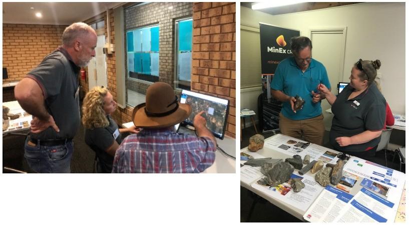
Community information sessions
The Geological Survey of NSW held free drop-in sessions for landholders and the wider community in Cobar and Lake Cargelligo in April 2019.