AusLAMP
AusLAMP crustal conductivity project
The Australian Lithospheric Architecture Magnetotelluric Project (AusLAMP) aims to establish a baseline deep-crustal electrical resistivity model 10–200 km deep across the Australian Continent. The collection of this data is an UNCOVER priority and will improve our understanding of deep-crustal structures and tectonic evolution. This knowledge will inform interpretations about crustal architecture and guide area selection for resource exploration.
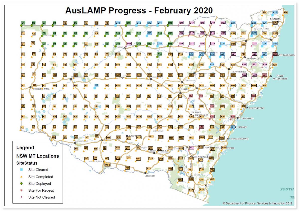
Status map of AusLAMP NSW acquisition as of February 2020. (See enlarged map).
AusLAMP long-period magnetotelluric (MT) data collection is a collaboration between GSNSW and Geoscience Australia (GA) under a National Collaborative Framework Agreement.
Field work for data acquisition is happening between July 2016 and December 2021. A map of the AusLAMP sites collected to date can be viewed in MinView and data and models from the survey can be directly downloaded by a left mouse-click over the map.
Full coverage of NSW will require approximately 320 AusLAMP sites spaced approximately 55 km apart. MT readings are measured by installing a set of electric and magnetic sensors connected to a data recorder. Instruments are placed at each site for 4–6 weeks to record very long period signals generated by natural electromagnetic energy interacting with Earth. Between 10 and 30 instruments are deployed at a time. Fieldwork started in the southeast of the state and is progressing toward the northeast corner.
Data are being analysed and modelled to create a 3D electrical resistivity model of Earth from 10 km to 200 km deep. Depth slices of the current 3D resistivity model can be viewed in MinView and correlated with other geological and geophysical datasets.
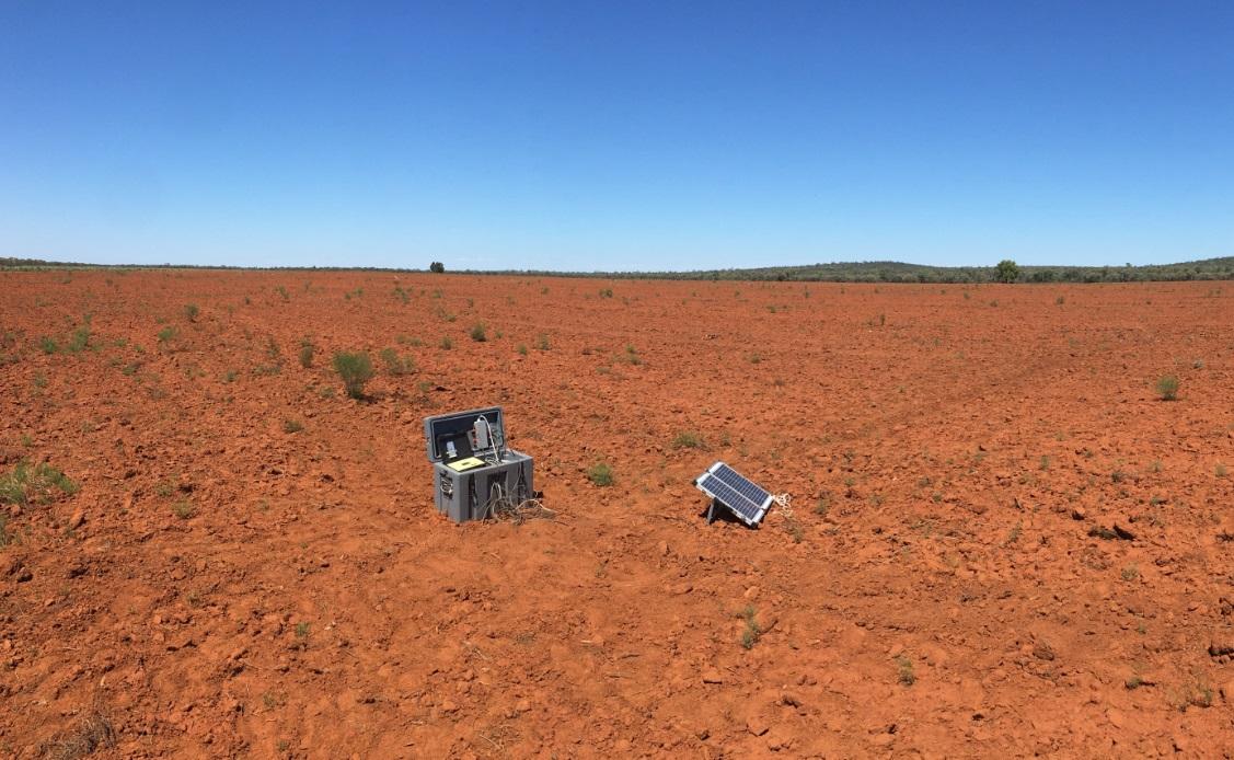
Typical set up of long-period MT instrumentation.