Coalfields maps
Coalfield maps are published at 1:100 000, 1:50 000 and 1:25 000 scales. The 1:100 000 series maps are accompanied by comprehensive explanatory notes which can be viewed in the DIGS® online report system.
NB: A guide to using the DIGS® online report system can be found here (PDF, 459.3 KB).
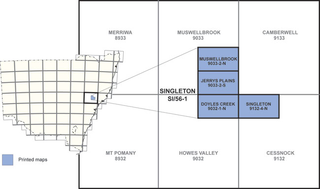
Coal field maps - 1:25 000
- Doyles Creek 1:25 000 Geological Map
- Jerrys Plains 1:25 000 Geological Map
- Muswellbrook 1:25 000 Geological Map
- Singleton 1:25 000 Geological Map
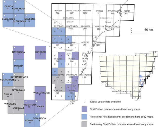
Coal field maps - 1:50 000
- Burragorang 1:50 000 Geological Map
- Coricudgy 1:50 000 Geological Map
- Glen Alice 1:50 000 Geological Map
- Glen Davis 1:50 000 Geological Map
- Jamison 1:50 000 Geological Map
- Katoomba 1:50 000 Geological Map
- Kiama 1:50 000 Geological Map
- Mellong 1:50 000 Geological Map
- Mittagong-Bullio 1:50 000 Geological Map
- Mossvale-Wingello 1:50 000 Geological Map
- Nowra-Toolijooa 1:50 000 Geological Map
- Olinda 1:50 000 Geological Map
- Robertson 1:50 000 Geological Map
- Windsor 1:50 000 Geological Map
- Wollongong 1:50 000 Geology Map
- Yerranderie 1:50 000 Geological Map
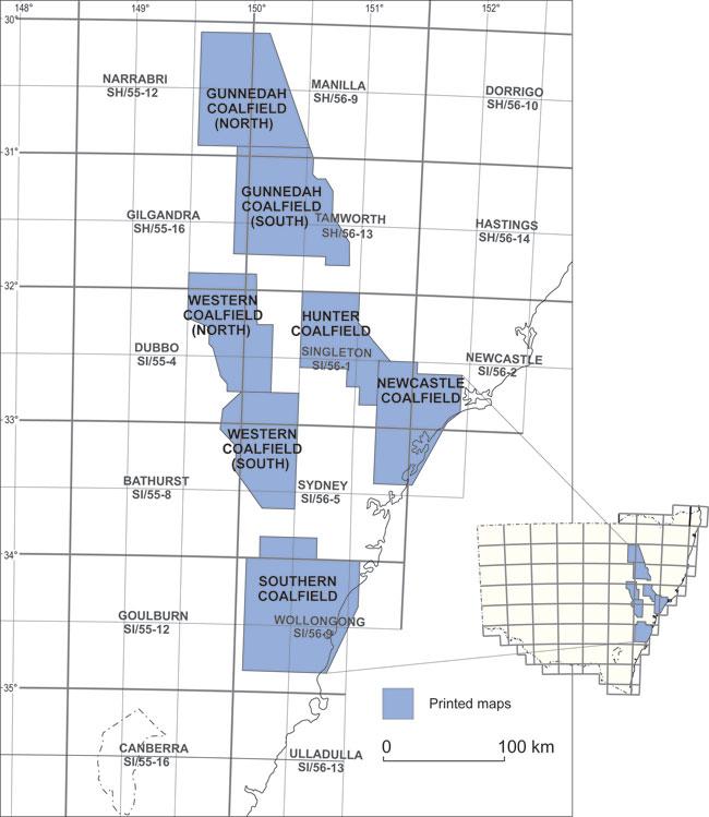
Coal field maps - 1:100 000
- Gunnedah Coalfield (north) Regional 1:100 000 Geology Map
- Gunnedah Coalfield (south) Regional 1:100 000 Geology Map
- Hunter Coalfield Regional 1:100 000 Geology Map
- Newcastle Coalfield Regional 1:100 000 Geology Map
- Southern Coalfield Regional 1:100 000 Geology Map
- Western Coalfield (north) Regional 1:100 000 Geology Map
- Western Coalfield (south) Regional 1:100 000 Geology Map