Geological maps
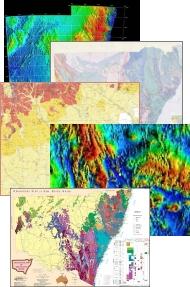
The Geological Survey of NSW publishes hard copy geological maps at several scales. The standard series maps are published at 1:250 000 and 1:100 000 scale, with the latter scale dominating current and future map products. Some 1:50 000 and 1:25 000 maps cover the Broken Hill and coalfields areas. More regional maps are printed at scales of 1:500 000 or more.
There is a near-complete coverage of the state at 1:250 000. Modern maps have good detail and comprehensive depictions of geology. However, sheets published prior to 1980 may lack the detail present in later maps. In addition to standard geological maps, the department has prepared a series of metallogenic maps depicting mineral occurrences and geology
Most hard copy maps are produced as a print run: however, high-quality, on-demand prints can be provided for early or provisional versions, out-of-print issues, or maps not scheduled for printing.
Available maps
- 1:25 000 Geological maps
- 1:50 000 Geological maps
- 1:100 000 Geological maps
- 1:250 000 Geological maps
- 1:500 000 Geological maps